The Problem: When Your Phone Lies About Speed
A bug report landed on a Tuesday, stark and simple: "Your app says I hit 400 kmph. I was at a red light." This wasn't a user error or a misinterpretation. The phone, the device ostensibly responsible for accurately tracking location and movement, genuinely believed it had recorded speeds far exceeding any legal or physical limit. For applications where trip accuracy is paramount—like mileage tracking for expenses or taxes—this kind of sensor hallucination isn't a minor bug; it's a product-defining failure.
Mileage tracking apps, by their nature, rely on continuous, precise location data. When the underlying sensor data is unreliable, the entire service breaks. Early versions of such apps might have accuracy rates hovering around 50 percent, with a significant portion of errors stemming from the phone itself providing wildly incorrect information. The challenge, then, is not just to collect data, but to ensure that data is trustworthy. This requires teaching the phone to be a more discerning witness, one that doesn't just report what it *thinks* it sees, but what it can reasonably infer is actually happening.
GPS: A Witness with a Concussion
We tend to treat GPS as an infallible source of truth, a digital notary public confirming our exact whereabouts. In reality, especially in the messy, unpredictable environments where people live and drive, GPS often behaves more like a witness who's taken a hard knock to the head. They are confident, cooperative, and frequently wrong. This unreliability stems from several common environmental factors that can easily disrupt satellite signals.
Three environments, in particular, break GPS badly:
- Tunnels: When a device enters a tunnel, it loses its line of sight to the GPS satellites. The device might try to extrapolate its position based on its last known speed and direction, or it might start reporting a static position, or worse, jump to a completely new, fabricated location once it exits the tunnel.
- Urban Canyons: Tall buildings can block or reflect GPS signals, a phenomenon known as multipath interference. This causes the receiver to get multiple delayed versions of the same satellite signal, leading to significant positional inaccuracies. The device might appear to be several meters or even tens of meters away from its actual location.
- Parking Garages: Similar to tunnels, parking garages offer little to no GPS signal. The device's location tracking can become completely lost, and upon exiting, it may report a sudden, impossible leap in position to catch up with reality.
Beyond these environmental factors, other issues contribute to GPS unreliability. Poorly calibrated sensors, software bugs, and even the phone's power-saving modes can all lead to inaccurate or missing location data. The core problem is that a GPS receiver is a passive device; it simply reports the signals it receives. It has no inherent understanding of physics, speed limits, or the common-sense constraints of the real world. It doesn't know that a car cannot instantly accelerate from 0 to 400 kmph, or that it cannot maintain that speed while stationary.
Teaching Skepticism: The Core Idea
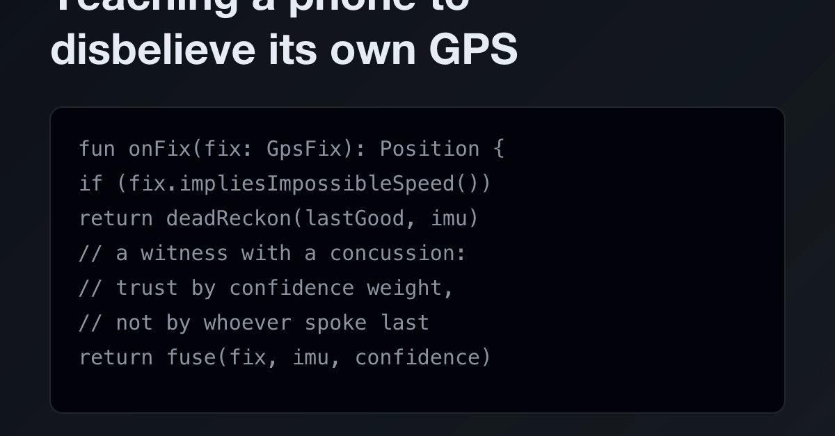
The fundamental insight is that the phone's GPS is not the only source of information about its movement. A device has other sensors: an accelerometer, a gyroscope, and even network information. By combining these, we can build a more robust understanding of the device's state. The key is to teach the system to be skeptical of the GPS data when it conflicts with other, more reliable indicators.
Consider a phone at a red light. Its GPS might report a sudden, massive jump in speed. However, the accelerometer would show virtually no acceleration. The gyroscope might indicate the phone is stationary. Network data might also suggest a fixed location. When GPS data suggests 400 kmph, but the accelerometer reports near-zero acceleration and the gyroscope confirms stillness, the system should learn to distrust the GPS reading. It's like having multiple witnesses to an event; if one witness gives a wildly unbelievable account that contradicts all others, you discount that witness's testimony.
This process involves developing a 'truth model' for the device's motion. This model fuses data from multiple sensors, weighting them based on their historical reliability and the current context. For example, in an open sky environment with good satellite reception, GPS might be heavily weighted. However, inside a tunnel or in an urban canyon, its weight would be drastically reduced, and the accelerometer and gyroscope would take precedence. The system learns to identify patterns of sensor failure and to cross-reference readings to detect anomalies.
The "So What?" Perspective
Developers working on location-aware applications must move beyond solely relying on GPS. Implement sensor fusion techniques, combining GPS with accelerometer, gyroscope, and network data. Build heuristics to detect and discard implausible GPS readings, especially regarding speed and sudden position changes. This requires a shift from treating GPS as ground truth to treating it as one noisy input among many.
While not a direct security vulnerability, unreliable GPS data can be exploited in applications requiring location verification, potentially leading to fraudulent claims or bypassing geo-fencing. Developers should consider how sensor fusion can harden applications against spoofed or erroneous GPS inputs, adding a layer of confidence to location-based security mechanisms.
For startups in the location-tracking space, data accuracy is a critical differentiator. Investing in robust sensor fusion and anomaly detection can significantly improve product reliability and user trust, reducing churn and support costs associated with erroneous data. This capability can become a competitive moat, particularly in B2B applications where precise tracking is non-negotiable.
Creators using location data for content generation or user engagement need to be aware of GPS unreliability. If your platform relies on user location for features, consider implementing checks to ensure data plausibility. This might involve smoothing location trails or flagging impossible movements to maintain a consistent and believable user experience.
The challenge of unreliable sensor data is common across many IoT and mobile applications. This approach highlights the need for robust data pipelines that incorporate anomaly detection and sensor fusion at the ingest or processing stage. Future research could focus on more sophisticated machine learning models that can dynamically adapt sensor weighting based on real-time environmental cues and device behavior.
Sources synthesised
- 14% Match